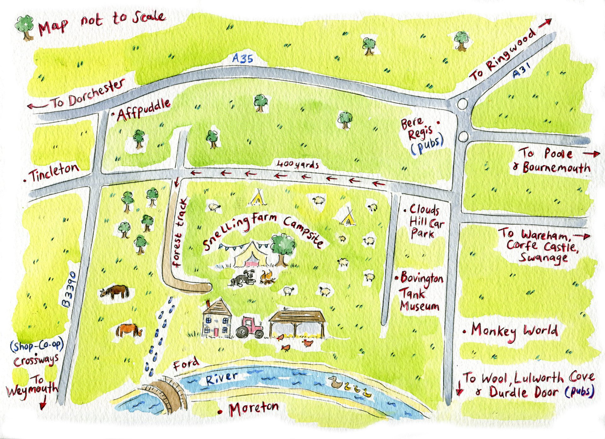
Directions
The campsite is located in the middle of no-where, with no recognizable postcode, so directions are important. Do not follow your Sat Nav anywhere near Moreton, this will attempt to take you through a deep river. Mobile phone signal is hit and miss so print off these directions and map and you will be sure to find us.
Sat Nav: For those of you who don't do old fashioned map reading you can enter these longitude and latitude co-ordinates in to your Sat Nav: 50.719875, -2.256937. On arrival at this point turn right or left down an unmade forest track. Continue down the forest track for 1 mile. Take the only turning left (footpath signposted Bovington) which takes you between 2 fields. On the bend continue straight through the farm gate and you will see the camping fields.
What3words: Another option is to download the app What3words and enter the combination insist.huts.faces This will take you to the turn off to the farm track from the main road. After this simply follow the long track for approx 1 mile. Take the only turning left signposted Snelling Farm and continue through the farm gate where you will see the camping fields.
Directions: Head to Bere Regis, Dorset and then for Wool, Monkey World, Tank Museum and Bovington Camp. Continue, following the road around to the left past the Royal Oak pub. After 2.5 miles, turn right for Bovington, Tincleton and Tank Museum. Continue for just over a mile, drive past the left hand turn for Clouds Hill/Bovington Tank Museum. You are taking the next left in 100 yards so start to slow down. Take the left hand turn down the forest track and continue down the track for approx 1 mile. Take the only turning left (footpath signposted Bovington), which takes you between 2 fields. On the bend continue straight through the farm gate and you will see the camping fields.